

RSPA Slo-Pitch Parks & Maps
Updated January 2, 2025 Diamonds on the map are clickable for detailed map and directions.

Alphabetical List of Parks
RSPA Team Park/Night Preference Request Form - PDF| Park | AB | Area | Address / Comments |
|---|---|---|---|
| Birchwood Park | BW | Mississauga South-West | Clarkson Road, east side, just north of Lakeshore Road West, west of Mississauga Road;
Lit diamond; Thursday; late games 8:30 only. |
| Brickyard
Park | BY | Mississauga South | 3061 Clayhill Road; east of Mavis Road; north of Dundas Street West;
Two fenced; lit diamonds; Diamond #1 is north diamond; diamond #2 is south diamond. |
| Centennial Park | CP | Etobicoke West | 256 Centennial Park Road M9C 5N3, north of Rathburn, west of Renforth; 3 lit unfenced diamonds.
Diamond #1 is north, closest to the arena; #2 is far diamond, south-west; #3 is south-east, closest to parking lot. |
| Century City
Park | CC | Mississauga Central | 933 Focal Road at Terry Fox Drive, east side, north off of Eglinton, west of Mavis Road.
unlit, early games only. |
| Diamond Beach | DB | Etobicoke West | NOT AVAILABLE - NO LONGER THERE - Centennial Park Boulevard (beside Mini Indy); one block west of Centennial Park and Centennial Park Drive, two blocks west of Renforth, north off of Rathburn, south of Eglinton. |
| Dunton
Park | DUN | Mississauga North | Kennedy Road, west side, north of Hwy 401; 4 lit, fenced diamonds; diamond #1 is big, close diamond, to the left; diamond #2 is the far diamond to the left; diamond #4 is diamond on the right, next to the parking lot; diamond #3 is the far diamond, past diamond #4. Monday, Tuesday and Friday nights. |
| Fleetwood
Park | FW | Mississauga East | Burnhamthorpe Road, south side; west of Mill Road, east of Dixie;
softball diamond at the front;
lit; fenced 225/250 feet; Wednesday, Thursday and Friday nights. |
| Forest Glen
Park | FGL | Mississauga East | Forest Glen Park is located at Glen Forest Secondary School, 3575 Fieldgate Drive, Mississauga L4X 1V5
East side of Fieldgate Drive, south off of Burnhamthorpe Road, or north of Bloor Street; unlit, unfenced. |
| Garnetwood
Park | GW | Mississauga East | Burnhamthorpe Road, north side; west of Mill Road, east of Dixie; across from Fleetwood Park;
GW-1: is the small softball diamond at the front; fenced; unlit; Mon-Tue-Wed; GW-2: is the large hardball diamond back and to the left; fenced; unlit; Wed-Thursday. |
| Heritage
Hills Park | HH | Mississauga Central | Huntington Ridge Drive, north side, take Heritage Hills Blvd. south off of Eglinton Avenue, one block east of McLaughlin Road; unlit; Monday; Wednesday. |
| Humberwood
Park | HW | Etobicoke North-West | 850 Humberwood Blvd., Etobicoke M9W 7A6; east side; north off of Rexdale; just east of 427; lit diamond; semi-fenced; Wednesday-Thursday. |
| Kings
Park | KP | Mississauga North | East side of Dixie Road north of Derry Road; 1/2 back-stop only; unlit, open field, half-backstop; 3 diamonds;
Access only from Dixie Road North and exits only to Dixie Road North; (was Derry Side Green Park);
Diamond #3 is to the left (north), closest to Dixie Road; Diamond #2 is to the right (south); Diamond #1 is south diamond, farthest east of Derry Road at the back. |
| Max Ward
Park | MX | Mississauga North | Matheson Blvd, north side, just west of Orbitor Drive, north of Eglinton; west of Renforth; two diamonds; both lit; fenced 315 feet. Diamond #2 is south diamond, closest to Matheson, by the parking lot. Diamond #1 is far, north diamond. For access to north diamond, park in the parking lot behind 5250 Orbitor Drive (Lakeside Process Controls - big white building), and walk through the walkway in the fence. PLEASE CLEANUP! |
| Mississauga
Valley | MV | Mississauga Central | Mississauga Valley Boulevard, west off of Central Parkway; just north of Bloor Street, between Cawthra & Hwy 10; parking lot take the driveway west behind the arena; diamond #1 is the hardball diamond in the center; diamond #2 is lit diamond to the east, fenced 225/250 ft.; diamond #3 is no longer there. |
| Mount Charles
Park | MC | Mississauga North | Cardiff Blvd., north side, north off Derry Road, west of Dixie Road; 2 lit diamonds (North and South); fenced 225/250 ft.; Tuesday. |
| Paul Coffey
Park | PC | Mississauga North
(Malton) | 3430 Derry Road East,South-west corner of Derry Road at Goreway (Disco Road); behind Malton Arena; take 427 north to Derry Road, take Derry Road west; 2 lit diamonds, one fenced; Dia #1 is far diamond, lit, unfenced; Dia #2 is close diamond, lit, fenced 225/250 ft. Formerly known as Wildwood Park. |
| River Grove
Park #3 | RIV | Mississauga West | 5800 River Grove Ave, Mississauga, ON L5M 4R8, west side, south off of Britannia Road, between Creditview and Queen Street (Mississauga Road); Rivergrove #3 is on the north of the community centre, or to the back right as you enter the complex, lit, fenced. |
| Sheridan
Park | SHP | Mississauga South-West | Speakman Drive, south of Sheridan Park Drive, west off of Erin Mills Parkway; south of Dundas Street; north of QEW; large, fenced, lit diamond; Wednesday and Thursday, late only. |
| West Deane
Park | WD | Etobicoke Central | Martin Grove Road, west side, between Eglinton & Rathburn;
2 diamonds, diamond #1 or L is close, lit diamond; diamond #2 is far, small, unlit diamond. |
| Willowvale
Field | WVL | Mississauga north-west | Willowvale Gardens, south side; east off Creditview Road; north of Eglinton;
unlit; Thursday. |
Check the current Park/Night List for available parks and nights;
Parks are always subject to change.
For a more complete map of all area parks:
Mississauga Parks — Etobicoke Parks
GTA - including: Etobicoke, Mississauga, Brampton, Niagara Falls, Scarborough, Markham, etc.
RSPA Parks


RSPA Home - SloPitch1.com Home - Site Map
For more information about RSPA Slo-Pitch
please contact: Randy Warren
e-mail: [email protected]
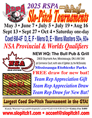
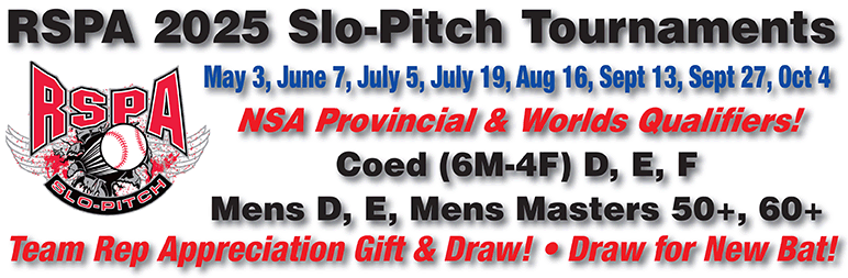
RSPA 2026 Slo-Pitch Tournaments
All tournaments tentatively Saturday one-day.Saturday, May 2 • June 13 • July 4 • July 25
• August 15 • Sept 12 • Sept 26 • Oct 3